Sheet 09 · Know Before You Go
How Far Is Key West? Distances from Miami, Orlando, and Fort Lauderdale
Road distances and realistic drive times to Key West from Miami, Fort Lauderdale, Orlando, Tampa and the Gulf Coast, the towns inside the Keys, and the flights, shuttles and ferry that can replace the drive.
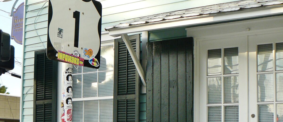
On a map of Florida, Key West looks like a short hop from Miami: a thin dotted line of islands trailing off the bottom of the peninsula. Then you drive it and discover that a road can be 158 miles long and still take most of a morning. So, how far is Key West from Miami? About 158 miles by road according to the Florida Keys’ official tourism office, or roughly 130 miles as the crow flies, and around four hours behind the wheel before you count a single stop for coffee, gas or a photo on the Seven Mile Bridge.
This guide gives the distance and realistic travel time from the main starting points, Miami, Fort Lauderdale, Orlando, Tampa and the Gulf Coast, plus the towns inside the Keys themselves, and explains why the last stretch always takes longer than the mileage suggests. It also covers the flights, shuttles, buses and the ferry that can replace the drive. Distances and fares were checked in November 2026 against the official tourism office, Monroe County, the airport and the operators’ own sites; road distances for other cities are for the fastest road route to Mile Marker 0.
How far is Key West? The quick table
Road distances below run to Mile Marker 0 at Whitehead and Fleming Streets in Old Town. Drive times are route-planner figures with no traffic and no stops, rounded; treat them as the floor, not the forecast.
| From | Road distance | Driving time, no stops | Nonstop flight to Key West? |
|---|---|---|---|
| Miami (airport) | About 158 miles | About 4 hours | Yes, American |
| Fort Lauderdale (airport) | About 186 miles | About 4.5 hours | Not on the airport’s current airline list |
| West Palm Beach | About 232 miles | About 5.5 hours | No |
| Naples | About 239 miles | About 6 hours | No |
| Fort Myers | About 303 miles | About 6.5 hours | No (but see the ferry below) |
| Orlando (airport) | About 387 miles | About 8 hours | Yes: Breeze from Orlando International; Allegiant from Orlando Sanford |
| Tampa | About 427 miles | About 9 hours | Yes, Breeze and Allegiant |
| Jacksonville | About 504 miles | About 10 hours | No |
| Atlanta | About 820 miles | About 16 hours | Yes, Delta |
Airline routes change with the seasons, so confirm a nonstop on the airline’s own schedule before you build a trip around it.
Miami to Key West
The official figure is about 158 miles from Miami by road, and it holds up: the drive from Miami International Airport to Mile Marker 0 comes out at just over 159 miles. On a clear day with no hold-ups that is about four hours of driving. Many people take closer to five, because the drive is too good to do without stopping.
The route
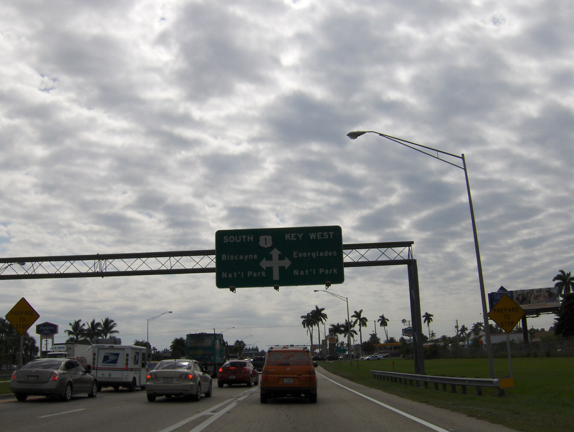
From Miami International Airport, the usual route is Florida’s Turnpike south to its end in Florida City, where it joins US 1. From there it is about 22 miles of mainland and mangrove before you reach Key Largo, and then the Overseas Highway carries you the rest of the way to Key West. Tolls on the Turnpike are cashless, so a SunPass or other compatible transponder saves the toll-by-plate admin fee on a rental.
Leaving Florida City, you have a choice. US 1 takes the 18-Mile Stretch straight down to Key Largo. The alternative is Card Sound Road, a quieter, older route with a high bridge and a toll: since October 1, 2026 a two-axle vehicle pays $2.18 with SunPass or $3.28 by plate, with no cash accepted. It rejoins US 1 in north Key Largo. It is not a shortcut in time, but on a weekend when the main road is busy it is a more relaxed way in.

Without a car
- Flight: American flies nonstop between Miami and Key West. It is the quickest way down, but once you add the airport time at both ends, the door-to-door saving over the drive is smaller than it looks.
- Keys Shuttle: door-to-door from Miami International, about four hours to Key West. The one-way base fare from Miami airport is $175 per person, with holiday and seasonal rates on top.
- Greyhound: three daily departures from Miami, fares from about $25 that vary by date, and a fastest trip of about four and a half hours.
Our Miami to Key West guide compares the options, including what each one costs once you add parking and transfers.
Fort Lauderdale to Key West
Fort Lauderdale adds about 27 miles to the Miami figure: from the airport to Mile Marker 0 is roughly 186 miles, or about four and a half hours with no stops. The official tourism office’s directions send you west on I-595 to Florida’s Turnpike, then south on the Turnpike to Florida City and US 1, which keeps you off the slower roads through Miami.
For travelers flying in, Fort Lauderdale is often cheaper to fly into than Key West, and that is the trade-off to weigh. Key West International’s current airline list shows no nonstop service from Fort Lauderdale, so the realistic options are to rent a car and drive, or to take Keys Shuttle, which runs from Fort Lauderdale airport to Key West in about four and a half hours. Brightline trains also link Fort Lauderdale and Miami, but there is no station anywhere in the Keys, so the train only gets you part of the way.
Orlando to Key West
This is the one people underestimate. Orlando International Airport to Key West is about 387 road miles, and the route planner puts it at a little over eight hours with no stops: Florida’s Turnpike south almost the entire length of the peninsula, then the full run of the Keys. With a lunch stop and the inevitable slow patches, it is a full day.
That makes it a reasonable road trip if the drive is part of the vacation, and a poor idea if you only have four or five days. Two better options:
- Fly direct. Breeze flies nonstop between Orlando International and Key West, and Allegiant flies from Orlando Sanford. Check the current schedule, because leisure routes like these often vary by season.
- Split the drive. Spend a night in Miami, Key Largo or Islamorada, and the Keys stop being the tiring last four hours of an eight-hour day.
Brightline runs between Orlando and Miami, which can take a large part of the drive off your hands. You still need a car, a shuttle or a bus for the final 160 miles.
Tampa, Naples, Fort Myers and the Gulf Coast
From the Gulf Coast, the road goes the long way round. There is no road down the west side of the Everglades to the Keys, so drivers head across the peninsula first: the official directions take you on I-75 across Alligator Alley and then down the Turnpike Extension to Florida City. That is why Naples, which looks close on a map, is about 239 road miles from Key West (about six hours), Fort Myers about 303 miles (about six and a half), and Tampa about 427 miles (about nine).
The ferry from Fort Myers Beach
The Gulf Coast’s shortcut is by water. The Key West Express leaves Fort Myers Beach at 8 a.m. and takes about three and a half hours to the Key West Bight ferry terminal in Old Town, against a drive of more than six hours. A full-fare adult round trip is $194, and a one-way adult ticket is $145; parking at the Fort Myers Beach terminal is $20 a day. Schedules vary by season and the crossing depends on the weather, so check the timetable for your dates. Our Key West Express guide covers the boat, the fares and the sea conditions.
Tampa also has nonstop flights to Key West on Breeze and Allegiant, which for most visitors makes more sense than nine hours in the car.
From farther away: where the nonstop flights come from
Beyond Florida, the question is less “how far” than “how many connections”. Key West International lists a respectable spread of nonstop routes, which means plenty of travelers from the Northeast, the Midwest and the South can reach the island without touching Miami at all. According to the airport’s own airline list in November 2026:
- American: Miami, Charlotte, Philadelphia, Dallas/Fort Worth, Chicago O’Hare, New York LaGuardia and Washington National.
- Delta: Atlanta and New York LaGuardia.
- United: Newark, Washington Dulles and Chicago O’Hare.
- JetBlue: Boston and New York JFK.
- Breeze: Orlando and Tampa, with Akron-Canton and Raleigh-Durham also listed.
- Allegiant: Tampa, St. Pete-Clearwater, Orlando Sanford, Asheville, Indianapolis, Cincinnati, Pittsburgh, Knoxville and Columbus Rickenbacker.
Many of these routes are seasonal and some fly only a few days a week, so check the airline’s schedule for your dates. If there is no nonstop from your home airport, connecting through Miami or Atlanta and flying into Key West usually beats flying to Miami and driving, unless the drive is something you actually want to do.
Distances inside the Florida Keys
Once you are in the Keys, distances are counted by the small green mile markers along US 1. They start at Mile Marker 127 near Florida City and count down to Mile Marker 0 at the corner of Whitehead and Fleming Streets in Key West, and addresses all the way down the chain are given by mile marker. Mile Marker 0 is also the southern end of US 1 itself, a highway that runs about 2,369 miles up the East Coast to Fort Kent, Maine, at the Canadian border. The markers are a rough guide to distance rather than an exact one: the official tourism office describes the Overseas Highway itself as about 113 miles long.

| From | Road distance to Key West | Driving time, no stops |
|---|---|---|
| Florida City (end of the Turnpike) | About 127 miles | About 3 hours 20 minutes |
| Key Largo (around MM 100) | About 99 miles | About 2 hours 40 minutes |
| Islamorada (around MM 82) | About 82 miles | About 2 hours 10 minutes |
| Marathon (around MM 50) | About 49 miles | About 1 hour 20 minutes |
| Bahia Honda State Park (MM 37) | About 37 miles | About 1 hour |
| Big Pine Key (around MM 30) | About 30 miles | About 50 minutes |
If you are deciding where along that chain to stay, our guide to where to stay in the Florida Keys sets the islands side by side.
Why the drive takes longer than the miles suggest
Four hours for 158 miles is an average of under 40 miles an hour, which sounds odd until you drive it. The reasons are worth knowing, because they are also the reasons to plan your timing.
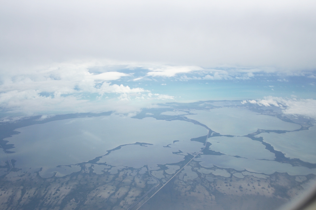
- One road. The Overseas Highway is the only road through the Keys. It runs for about 113 miles across 42 bridges, and when a crash or a breakdown blocks it, there is no way around.
- Towns, not freeway. The highway runs straight through Key Largo, Islamorada, Marathon and the Lower Keys, with traffic lights, turning traffic, lower limits through the built-up areas and long sections with a single lane each way.
- Key deer country. On Big Pine Key and the neighboring islands, reduced speed limits protect the endangered Key deer, and they are enforced. Watch the signs, especially after dark.
- The bridges. The Seven Mile Bridge alone runs about 6.8 miles from Knight’s Key in Marathon to Little Duck Key, and there is nowhere to stop on it.
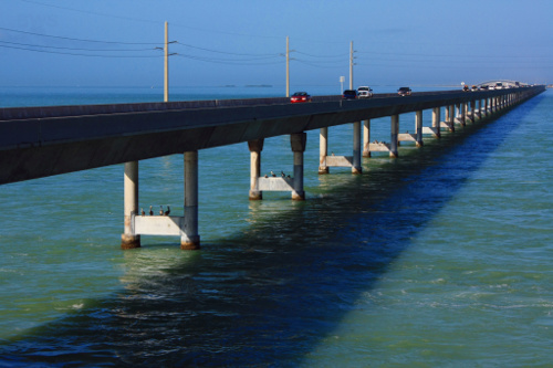
None of this is a reason not to drive. It is a reason to leave early, travel in daylight if you can, and budget for the stops you will want to make. Our guide to the drive to Key West picks out the stops worth making, mile marker by mile marker, and the Seven Mile Bridge guide covers the old bridge you can walk and cycle.
How far is Key West from Cuba, the Dry Tortugas and the Bahamas?
The famous painted buoy says 90 Miles to Cuba. The real figure is about 95 statute miles from Key West to the closest point of Cuba, and the Florida Keys tourism office rounds it to 90 as well. Key West is, in other words, closer to Cuba than to Miami.
The Dry Tortugas, the remote national park with Fort Jefferson at its heart, are about 70 miles west of Key West, reached by the Yankee Freedom ferry or by seaplane. Our Dry Tortugas day trip guide covers both.
For the Bahamas, there is no regular ferry or nonstop service from Key West; trips to the islands usually go through South Florida’s mainland airports and ports. Our guide to getting from Key West to the Bahamas explains the options.
Is Key West worth the drive, or a day trip from Miami?
The drive itself is worth doing once. The stretch from Marathon south, with the Seven Mile Bridge and the Lower Keys opening up on both sides, is genuinely one of the great drives in the country, and the Keys you pass through are destinations in their own right.
A day trip from Miami is a different matter. Eight hours of round-trip driving for a few hours in Key West leaves you with sunset at Mallory Square and a long, tired drive back in the dark, through Key deer country. If time is that tight, an early flight or at least one night on the island is a far better use of the day. Organized bus tours do make the round trip, but you spend most of the day in your seat.
From Orlando, Tampa or anywhere further north, the honest answer is: fly, or make the drive a two-day trip with a night in the Upper Keys. Arriving in Key West after nine hours on the road is not how you want to start a vacation.
Frequently Asked Questions
How long is the drive from Miami to Key West?
About four hours with no stops, for a distance of about 158 miles by road. With a stop or two, many people take closer to five. Traffic in the Upper Keys on busy weekends and holidays can stretch it further.
How far is Key West from Orlando?
About 387 road miles from Orlando International Airport, which is a little over eight hours of driving without stops. Breeze flies nonstop from Orlando International, and Allegiant from Orlando Sanford.
How far is Key West from Fort Lauderdale?
About 186 road miles from Fort Lauderdale airport, or roughly four and a half hours without stops. Keys Shuttle runs from Fort Lauderdale airport to Key West in about four and a half hours.
How far is Key West from Tampa?
About 427 road miles, around nine hours without stops, because the road crosses the peninsula before heading south. Breeze and Allegiant fly nonstop between Tampa and Key West.
Can you do Key West as a day trip from Miami?
You can, but it means around eight hours of driving for a few hours on the island. Stay at least one night if you possibly can.
How long is the Seven Mile Bridge?
About 6.8 miles, from Knight’s Key in Marathon to Little Duck Key. It is roughly 40 to 47 miles from Key West, measured by mile marker.
How far is Key West from Cuba?
About 95 statute miles to the nearest point of Cuba. The Southernmost Point buoy rounds it down to 90.
Where does US 1 end?
At Mile Marker 0, at the corner of Whitehead and Fleming Streets in Key West, where the green marker and the “End US 1” sign make a popular photo stop.
Related Key West Guides
- Miami to Key West: every way to make the trip
- Driving to Key West on the Overseas Highway
- Getting to Key West
- Key West International Airport
- The Key West Express ferry
- The Seven Mile Bridge
- Do you need a car in Key West?
- Key West FAQ
Photo Credits
Featured image: the End US 1 and Mile 0 signs in Key West: End of Route No. 1 – panoramio by qwesy qwesy, CC BY 3.0, via Wikimedia Commons.
US 1 southbound sign for Key West: US 1 south at SR 9336 by Peter Dutton from Forest Hills, Queens, USA, CC BY 2.0, via Wikimedia Commons.
Card Sound Bridge: Card Sound Bridge (35414046564) by GR from Key Largo, Public domain, via Wikimedia Commons.
Jewfish Creek and its bridge from the air: JewfishCreek-p by DrReload, CC BY-SA 4.0, via Wikimedia Commons.
Traffic on the Seven Mile Bridge: A324, Seven Mile Bridge, Florida Keys, USA, 2010 by Brian W. Schaller, FAL, via Wikimedia Commons.
The Overseas Highway between Florida City and Key Largo from the air: Aerial view of the Overseas Highway between Florida City and Key Largo, 2007-12-07 by enrique galeano morales, CC BY 2.0, via Wikimedia Commons.
Sources & corrections
Rates, hours and closures verified against operator listings and on-island visits. Prices are peak-season unless noted.