Sheet 07 · Florida Keys
Florida Keys Overseas Heritage Trail: Biking the Island Chain
Flagler's railroad route as a bike path: how much of the 106-mile trail is finished, the historic bridges worth riding, a four-day Key Largo to Key West itinerary, and the wind, heat and traffic realities.
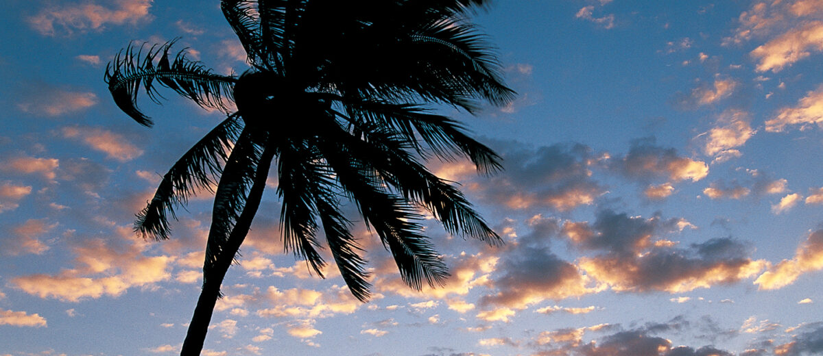
Somewhere past the middle of the old Long Key Viaduct you stop pedaling, because you realize the only sounds left are the wind, the water slapping the concrete arches below and a pelican landing on the railing twenty feet away. The cars on the new bridge are a hundred yards off and strangely silent. Behind you is a ribbon of islands; ahead is nothing but green water and sky. That moment, repeated on bridge after bridge down the island chain, is the whole point of the Overseas Heritage Trail — the Florida Keys Overseas Heritage Trail, a paved path for bikes and feet that follows the route of Henry Flagler’s railroad from Key Largo toward Key West.
This guide covers what the trail actually is and how much of it is finished, the best sections for a ride of an hour, a day or a week, the historic bridges you can ride and fish from, the wind, heat and traffic realities nobody puts in the brochure, bike rentals and where to stay, and whether riding the whole thing is a good idea. Details were checked in September 2026 against Florida State Parks and trail-organization sources; sections do close for repairs, so check current trail alerts before you plan a long ride around one bridge.
The Overseas Heritage Trail at a glance
| Detail | Information |
|---|---|
| Official name | Florida Keys Overseas Heritage Trail (a Florida State Parks trail) |
| Planned length | 106 miles, Key Largo (MM 106) to Key West (MM 0) |
| Separated multi-use path | About 90 miles |
| On-road sections | About 15 miles shared with traffic on road shoulders |
| Historic railroad bridges | 23 incorporated; the longest bridge crossing on the route is about 7 miles |
| Surface | Paved asphalt path and concrete bridge decks |
| Cost | Free — no permit or entry fee to use the trail |
| Who can use it | Cyclists, walkers, runners, skaters; anglers on designated fishing bridges |
| Shade and water | Very little shade; water from shops and gas stations along US 1 |
| Best months | November to April — cooler, drier, less humid |
| Typical bike rental | Varies by town and bike type; check current rates |
| Full-length ride | Most riders take 3 to 5 days |
What the trail is
Between 1905 and 1912, Henry Flagler’s Florida East Coast Railway built the Over-Sea Railroad from the mainland to Key West, a project so improbable that people called it Flagler’s Folly. It ran across open water on long concrete viaducts and steel spans until the Labor Day hurricane of 1935 wrecked the line in the Upper Keys. The railway never rebuilt; the state bought the right of way, and within a few years cars were driving across the old railroad bridges on what became the Overseas Highway.
In the 1970s and 1980s, the highway got new, wider bridges alongside the old ones. The originals were left standing beside them — some as fishing piers, some fenced off, some slowly crumbling into the channels. The Overseas Heritage Trail is the long project to turn that leftover corridor into a continuous path: paved trail on the islands, and the restored historic bridges, or the shoulders of the modern ones, over the water.
It is not a wilderness trail. For most of its length it runs within sight and earshot of US 1, the only road through the Keys, which carries a steady stream of traffic. Think of it as a scenic, mostly separated bike path alongside a highway, broken up by extraordinary stretches over the water. The bridges are what make it; the island sections in between range from pleasant tree-lined path to a strip of asphalt beside a strip mall.
How complete is it?
About 90 miles of the planned 106 are separated, off-road multi-use trail. Roughly 15 miles are on-road sections, where you ride the shoulder or a marked bike lane with traffic beside you — most notably across several of the modern highway bridges, where the historic span next door is either unsafe, too narrow or has a missing section. Work to close the remaining gaps continues. Individual bridges and short stretches close from time to time for repairs, and some old fishing bridges have been shut for safety; the state parks website posts alerts, and it is worth checking before you plan a ride around one specific bridge.
The best sections of the trail
You do not have to ride the whole trail to get the best of it. The highlights cluster in the Middle Keys, where the islands are furthest apart and the bridges are longest. These are the sections worth driving to with a bike on the back of the car.
1. The Old Seven Mile Bridge to Pigeon Key (Marathon, MM 47)
The most famous stretch of the trail and, for a first ride, the best. A 2.2-mile section of Flagler’s original bridge has been restored for walkers and cyclists, running from the Marathon end out to Pigeon Key, the small island where the railroad’s construction workers lived. It is car-free, flat and completely over the water, with the new Seven Mile Bridge running alongside and nothing between you and the horizon. Out and back is 4.4 miles. Go at sunrise or late afternoon; midday in summer on a white concrete deck is brutal. The history of the bridge, parking and the Pigeon Key visit are in our Seven Mile Bridge guide.

Beyond Pigeon Key the old bridge is closed, with a large gap where the swing span was removed. If you are riding through to the Lower Keys, you cross the remaining miles on the shoulder of the modern bridge — a wide shoulder, but with 55 mph traffic and trucks a few feet away and the kind of crosswind that pushes a bike around. Confident riders do it routinely. Nervous riders should not.
2. The Long Key Viaduct (MM 63–65)
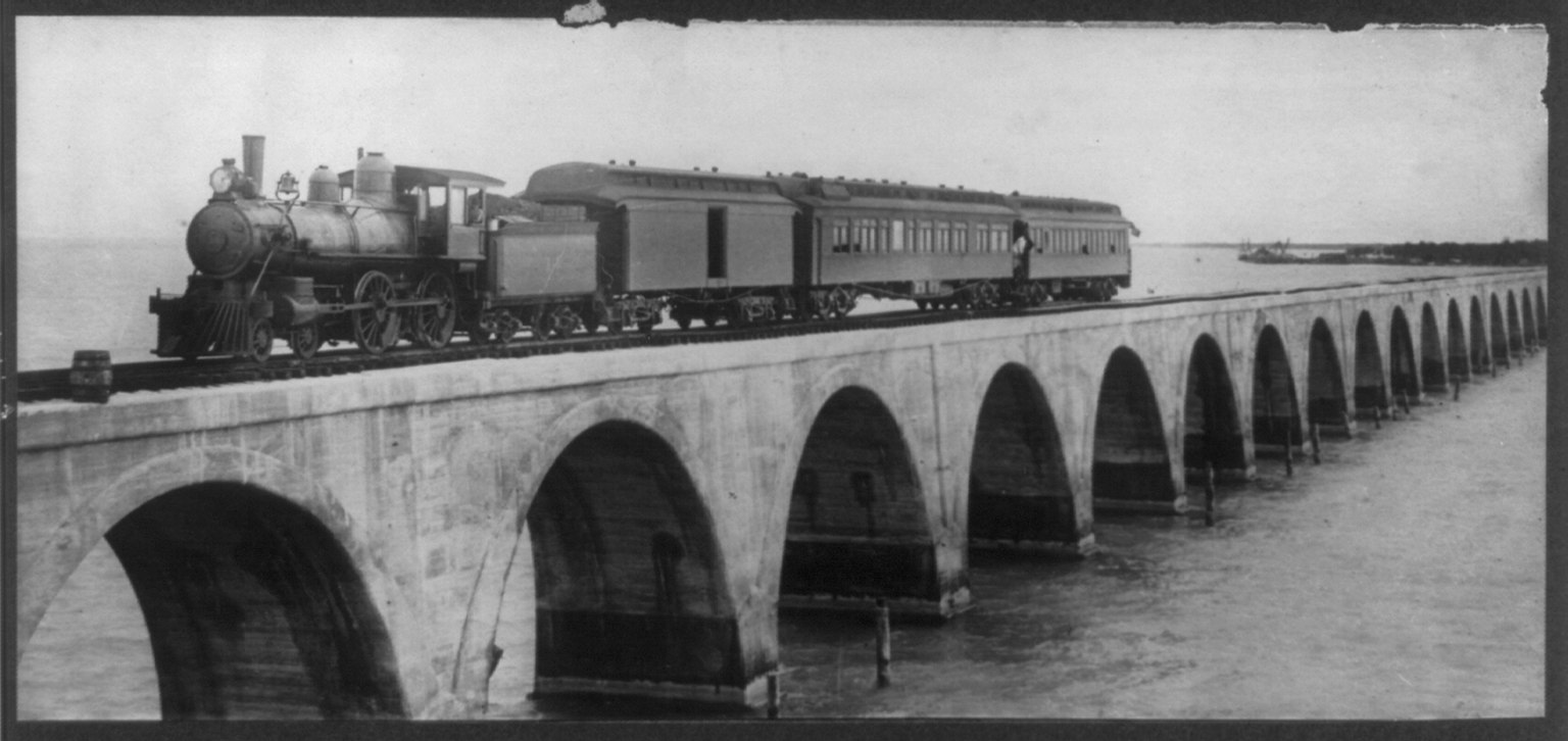
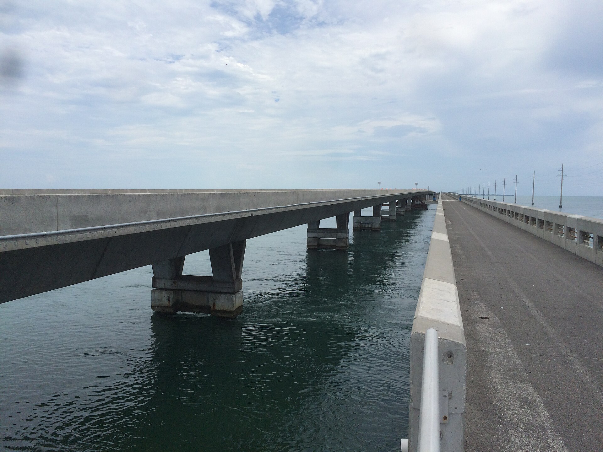
The Long Key Viaduct was the showpiece of Flagler’s railroad, a run of just over two miles of graceful concrete arches that appeared on the railroad’s own promotional material. The old span is now a fishing bridge and part of the trail, open to cyclists and walkers, with the modern highway bridge beside it. It is quieter than the Seven Mile Bridge and, arguably, more beautiful — especially early in the morning, when anglers are setting up along the rail and the light comes in low across the Atlantic side. Long Key State Park, next door, is a good place to break the ride.
3. Channel 5 and the Matecumbe bridges (Islamorada to Long Key, MM 71–73)
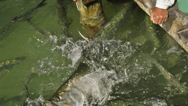
South of Islamorada, the trail crosses a run of shorter historic bridges, including Channel 5 with its trailhead parking lot. These are popular fishing spots, with platforms added on some spans. Ride them early, when the water is flat and you can see rays and barracuda cruising the channels underneath. Short stretches around MM 71 have closed for repairs in the past, so check alerts. Robbie’s, where you can feed the tarpon, is just up the road at MM 77.5 — see our Robbie’s of Islamorada guide.
4. Tom’s Harbor and Grassy Key (MM 58–61)
Between Duck Key and Grassy Key, the trail uses the restored Tom’s Harbor bridges, with platforms for fishing and sightseeing. It is a short, easy section with good views, and it is close to the Dolphin Research Center at MM 59 if you want to combine a ride with a visit.
5. Bahia Honda (MM 37)
The old Bahia Honda railroad bridge is the tall steel truss you see from the highway, with its famous missing section. You cannot ride across it, but the approach from inside Bahia Honda State Park takes you up onto a viewing platform on the old span, with one of the best views in the Keys. The ride around the park, with a swim at the end, is an excellent half day. Park entry applies; our Bahia Honda State Park guide has the details.
6. Big Pine Key and the Lower Keys (MM 33–10)
Through the Lower Keys the trail is flatter, quieter and less dramatic, running past mangroves and small islands with shorter bridges. On Big Pine Key, the speed limit on US 1 drops to protect the endangered Key deer, and you have a very real chance of seeing them along the trail edge early or late in the day. Do not feed them, and give them room. Our Key deer guide explains where to look.
Section by section: the full trail
| Section | Mile markers | Approx. distance | What it is like |
|---|---|---|---|
| Key Largo | MM 106–91 | 15 miles | Separated path through a busy commercial strip; shaded in places; lots of driveways to cross |
| Tavernier to Islamorada | MM 91–74 | 17 miles | Mostly path; heavy traffic, restaurants and marinas; slow going on weekends |
| Islamorada to Long Key | MM 74–63 | 11 miles | The first real water crossings; Channel 5 and the Long Key Viaduct |
| Long Key to Marathon | MM 63–47 | 16 miles | Conch Key, Duck Key, Tom’s Harbor bridges, Grassy Key |
| Marathon and the Seven Mile Bridge | MM 53–40 | 13 miles | Town riding, then the restored bridge to Pigeon Key and the modern bridge shoulder |
| Bahia Honda to Big Pine | MM 40–30 | 10 miles | Bahia Honda, short bridges, Key deer country |
| Lower Keys to Stock Island | MM 30–5 | 25 miles | Quiet, flat and remote; fewer services |
| Stock Island to Key West | MM 5–0 | 5 miles | Into town; busier, then Key West’s own bike lanes and side streets |
Distances are approximate and follow the highway mile markers; the trail itself winds a little more.
Riding the whole thing
Riding the full length of the Keys is a genuine bucket-list trip, and a very achievable one for any reasonably fit rider — it is almost completely flat. But be clear-eyed about what you are signing up for.
The good
- No hills at all. The only climbs are the gentle ramps up onto the bridges.
- Services everywhere: food, water, bike shops and places to stay in every town.
- Scenery that no other long-distance bike trail in America can match on its best days.
- Easy logistics: one road, one direction, mile markers counting down to zero.
The hard parts
- Wind. The Keys are exposed and the wind rarely stops. The prevailing breeze is from the east and southeast, which for a southbound rider is often a crosswind or a partial tailwind. Winter cold fronts swing the wind round to the north for a few days, which can help southbound riders — or, after the front passes, bring a stiff headwind. On the long bridges, a 15-knot crosswind is hard work and genuinely unnerving next to traffic.
- Heat and sun. There is almost no shade on the bridges and not much on the islands. Between June and September, a 50-mile day is dangerous without very early starts, a lot of water and electrolytes.
- Traffic. On the on-road sections, you are riding on a shoulder next to US 1. Most drivers are considerate. Some are not, and a few are looking at the view instead of the road.
- Driveways and crossings. In Key Largo and Islamorada especially, the path crosses dozens of business entrances and side roads. Drivers turning in often do not look for bikes.
- Getting to the start. The trail begins in Key Largo. The road from Florida City down to Key Largo — the “18-mile stretch” of US 1 — is not a place to ride a bike. Most people drive or take a shuttle to Key Largo and start there.
A sample 4-day itinerary, north to south
| Day | Route | Distance | Highlights |
|---|---|---|---|
| 1 | Key Largo to Islamorada | About 25–30 miles | An easy first day; afternoon at Robbie’s or on the water |
| 2 | Islamorada to Marathon | About 30 miles | Channel 5, the Long Key Viaduct, Tom’s Harbor |
| 3 | Marathon to Big Pine Key | About 20 miles | Seven Mile Bridge, Bahia Honda swim, Key deer at dusk |
| 4 | Big Pine Key to Key West | About 30 miles | Quiet Lower Keys, then a finish at the Southernmost Point |
Stronger riders do it in three days; many people prefer five, with a rest day in Marathon. Commercial tour operators also run supported trips with luggage transfer and a sag wagon, which removes most of the logistical headaches. For choosing bases along the way, our Key Largo, Islamorada, Marathon and Big Pine Key guides cover where to stay.
When to ride
| Months | Conditions | Verdict |
|---|---|---|
| November – April | Highs in the 70s to low 80s °F, low humidity, occasional strong winds after cold fronts | Best time to ride |
| May and October | Hot and increasingly humid; October still carries hurricane risk | Good with very early starts |
| June – September | Highs around 90°F with high humidity, heat index often over 100°F, daily storms, hurricane season | Short rides only, at dawn |
Whatever the month, start early. The light is better, the wind is usually lighter, the traffic is quieter and the heat has not built. For month-by-month temperatures and rain, see our Key West weather guide.
Bikes, rentals and gear
What kind of bike
Any bike works on a flat paved path, but for anything longer than a few miles, a hybrid or road bike with slightly wider tires is far more comfortable than a heavy beach cruiser. Beach cruisers are fine for the Old Seven Mile Bridge out and back; they are miserable for 30 miles into a headwind. E-bikes have become common on the trail and take much of the sting out of the wind — ride them at a speed appropriate for a shared path, and check the current state park rules on motorized bikes before you set off.
Renting
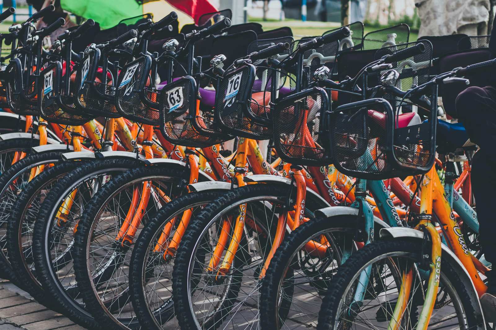
You can rent bikes in Key Largo, Islamorada, Marathon, Big Pine Key and Key West. Most rental shops stock cruisers and hybrids, and increasingly e-bikes; fewer have proper road bikes, and one-way rentals for the full trail are limited, so reserve well in advance if you want to pick up in Key Largo and drop off in Key West. Rates vary by shop and bike type — check them when you book. If you are only riding around Key West itself, our Key West scooter rentals guide compares bikes, scooters and electric carts for getting around the island.
What to carry
- At least two large water bottles, and more in summer — refill at every opportunity
- Sunscreen, sunglasses, a lightweight long-sleeved sun shirt
- A helmet — not optional next to US 1
- Front and rear lights, even for daytime riding on the bridges
- A spare tube, a pump and tire levers; broken glass and shell fragments cause flats
- A lock for stops — bike theft happens in every Keys town, and Key West especially
- A rain jacket in summer for afternoon storms
- A phone with the mile markers noted for places you plan to stop
Safety on the trail
- Watch driveways and intersections. Assume a car turning in or out has not seen you.
- Ride predictably on the modern bridges. Hold a straight line on the shoulder, keep right, and do not stop on the bridge except at designated pull-outs.
- Get off the bridges in lightning. A long, exposed bridge is the wrong place to be in a Keys thunderstorm. If a storm is building, wait it out on land.
- Share the fishing bridges. Anglers cast across the path. Slow down, ring a bell and watch for lines and hooks.
- Give wildlife room. Key deer, iguanas and birds wander onto the trail. Slow down in the Big Pine speed zone.
- Do not ride at night on the on-road sections. The shoulders are poorly lit and the traffic is fast.
Is the Overseas Heritage Trail worth it?
For a short ride over one or two of the historic bridges, absolutely — it is one of the most memorable free things to do in the Keys, and the Old Seven Mile Bridge at sunrise or the Long Key Viaduct in the early morning are as good as anything you will pay for. For keen cyclists, riding the full length is a satisfying and unusual trip.
Where it falls short is expectations. If you are imagining 106 miles of quiet, car-free paradise, you will be disappointed by Key Largo’s strip malls, the long stretches of path beside four lanes of traffic and the white-knuckle on-road bridge crossings. Plan your trip around the best sections, ride them in the cool of the morning, and use a car or a supported tour to skip the parts that are merely functional. Our Key West outdoor activities guide has other ways to spend an active day at the end of the road, and the drive to Key West guide covers the same route by car.
Frequently asked questions
How long is the Overseas Heritage Trail?
The trail is planned to run 106 miles from Key Largo to Key West. About 90 miles are separated multi-use path and roughly 15 miles are on-road sections shared with traffic, with work continuing to close the remaining gaps.
Is the Overseas Heritage Trail free?
Yes. There is no fee to use the trail itself. You pay only for entry to state parks along the way, such as Bahia Honda, if you choose to visit them.
Can you bike from Key Largo to Key West?
Yes, and many people do, usually over three to five days. Expect some on-road riding on bridge shoulders beside US 1, strong winds and very little shade. Most riders start in Key Largo rather than on the mainland, because US 1 between Florida City and Key Largo is not safe for cycling.
Can you ride across the Seven Mile Bridge?
Yes. The restored 2.2-mile section of the old bridge from Marathon to Pigeon Key is car-free and open to cyclists and walkers. To continue to the Lower Keys, cyclists ride the shoulder of the modern Seven Mile Bridge, alongside highway traffic.
What is the best section of the trail for a short ride?
The Old Seven Mile Bridge from Marathon to Pigeon Key, 4.4 miles out and back and completely over the water. The Long Key Viaduct is a quieter, equally beautiful alternative.
Can I fish from the trail bridges?
Yes, many of the old railroad bridges along the trail are designated fishing bridges, some with added platforms. You need a Florida saltwater fishing license unless you are exempt, and you must follow state size and bag limits.
When is the best time of year to ride the trail?
November through April, when temperatures are in the 70s and low 80s and the humidity is low. In summer, ride only at dawn and keep distances short.
Are e-bikes allowed on the Overseas Heritage Trail?
E-bikes are widely used on the trail. Rules on motorized bikes on state trails can change, so check the current Florida State Parks guidance before your trip, and ride at a speed that is safe for a path shared with walkers and anglers.
Related Key West Guides
- Seven Mile Bridge — the trail’s most famous crossing and Pigeon Key
- Key West scooter rentals — bikes, scooters and carts at the end of the trail
- Key West outdoor activities — paddling, snorkeling and more active days
- The Florida Keys beyond Key West — every island on the chain
- Bahia Honda State Park — the old bridge viewpoint and a swim
- Marathon Florida Keys — the natural halfway base for a full ride
- Looe Key Reef — a snorkel break for riders staying in the Lower Keys
Photo Credits
Cyclists at sunrise by the old Bahia Honda Bridge: Florida Keys Scenic Highway – Sunrise from the Florida Keys Overseas Heritage Trail – NARA – 7718429 by Unknown author Unknown author or not provided, Public domain, via Wikimedia Commons.
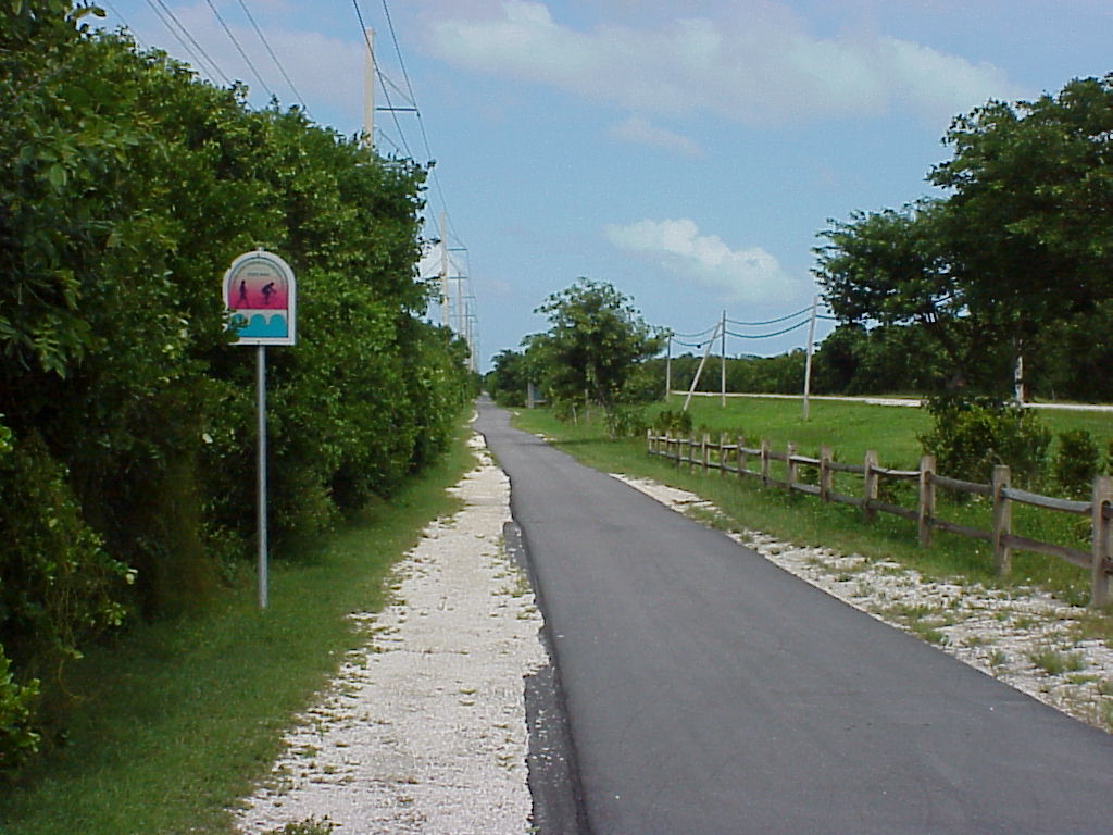
Overseas Heritage Trail path and marker: Florida Keys Scenic Highway – Overseas Heritage Trail – NARA – 7718444 by Unknown author Unknown author or not provided, Public domain, via Wikimedia Commons.
First train on the Long Key Viaduct: H.M. Flagler’s Special, first train crossing Long Key Viaduct, 2.7 miles long, Long Key, Fla. LCCN2005694817 by John N. Chamberlain, Public domain, via Wikimedia Commons.
Old and new Long Key bridges: Long Key Bridge by Sanibel sun, CC BY-SA 4.0, via Wikimedia Commons.
Sources & corrections
Rates, hours and closures verified against operator listings and on-island visits. Prices are peak-season unless noted.